|
[Project
Description | Problem | Volunteer
Opportunities | Project
Partners]
Project Description
What fish live - or should be able to live -
in the small streams of the Assabet and Concord River watershed?
What happens to water levels and water quality in these small
streams during the summer dry season? Are the streams healthy
habitat for fish when water levels drop in streams? How can
we do a better job of protecting fish habitat in the Assabet
watershed?
 |
|
StreamWatch Project
press announcement, Nov 01
|
StreamWatch is designed to answer these questions
and to make the data we collect available on web. The project,
originally funded by an EPA grant, started in January 2002
and continues as part of OAR's long-standing water quality
monitoring program.
Problem
While the small tributary streams of the Assabet
and Concord River watershed do not suffer eutrophication to
the same degree as the mainstem rivers, they face problems
of their own. The I-495 corridor on the western edge of the
watershed, has been (and continues to be) one of the fastest-growing
regions in Massachusetts in recent years. The industrial,
commercial, and residential growth has put pressure on the
region's natural resources, particularly its groundwater,
river, and small streams.
 |
|
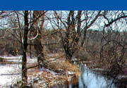
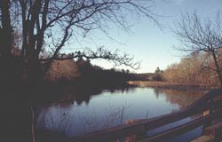
Assabet River,
Boon Rd, Stow
|
The protection and sustainability of these resources
has become a serious concern. Most Assabet communities use
water from ground water sources and discharge into the river,
failing to replenish the local aquifers. These aquifers supply
the clean, pure groundwater "baseflow" that is essential
to keep the smaller streams flowing during the summer dry
season. As the groundwater levels drop, the streams also dry
up, and there is less baseflow available to the Assabet River
to dilute the wastewater treatment effluent. During dry summers
most of the Assabet watershed communities have needed to institute
water-use restrictions of some type.
One of the goals of StreamWatch is to help watershed
residents understand the connection between summertime low
flows - and their own land and water use - and the health
of both fish in local streams and local drinking water sources.
.jpg) How?
OAR staff and volunteers measure water quality and quantity
in the streams and compare the findings with healthy conditons
for fish using a "Stream Health
Index." The Stream Health readings are displayed
each week on signs in the participating communities. The index
readings and supporting data are also available on this website
(click on "data" under each of the stream pages). How?
OAR staff and volunteers measure water quality and quantity
in the streams and compare the findings with healthy conditons
for fish using a "Stream Health
Index." The Stream Health readings are displayed
each week on signs in the participating communities. The index
readings and supporting data are also available on this website
(click on "data" under each of the stream pages).
Staff Scientist Sue Flint is OAR's project manager
for the StreamWatch project.
Volunteer Opportunities
Learn first hand about the river and its tributaries;
become a StreamWatch volunteer! You'll learn how to take
measurements at one of our training sessions and you'll work
with our team of volunteers over the summer. The data that
you collect will help us understand the long term trends in
the condition of the river and tributaries and give us a snap-shot
of conditions in the tributaries each week. You can help in
two ways:
- Our monthly sampling teams collect
water quality data on five Saturdays from June to September
at sites along the Assabet River and in the tributaries.
You can sign up to help on all four Saturday or as few as
two.
- Individual volunteers work on their
own schedule each week from June to September to read a
staff gage at one of our StreamWatch sites and/or update
the StreamWatch sign for that site.
|
Volunteer opportunities for the summer of 2004 are
filled. Email
to be added to the contact list for 2005.
Water quality sampling
dates for 2005:
Coming soon...
|
Project Partners (2002
- 2004)
 The
Assabet River Consortium is comprised of six communities with
a common interest in the Assabet River. Hudson,
Marlborough,
Maynard,
Northborough,
Shrewsbury,
and Westborough
discharge treated effluent from wastewater treatment facilities
into the river. The purpose of this Consortium is to address
regional wastewater treatment and disposal issues. Operating
under a requirement of their respective treatment facilities'
National Pollutant Discharge Elimination System (NPDES) permits
with the Massachusetts Department of Environmental Protection
and the U.S. Environmental Protection Agency (EPA), the Consortium
is preparing a Comprehensive Wastewater Management Plan and
Environmental Impact Report, known as CWMP/EIR, to study regional
wastewater treatment issues that affect the communities of
the Assabet River. The consortium represents a departure from
the region's history of parochialism. There are very few instances
in New England where communities, such as the Assabet communities,
have joined together to provide a basin-wide approach to solve
environmental issues. The
Assabet River Consortium is comprised of six communities with
a common interest in the Assabet River. Hudson,
Marlborough,
Maynard,
Northborough,
Shrewsbury,
and Westborough
discharge treated effluent from wastewater treatment facilities
into the river. The purpose of this Consortium is to address
regional wastewater treatment and disposal issues. Operating
under a requirement of their respective treatment facilities'
National Pollutant Discharge Elimination System (NPDES) permits
with the Massachusetts Department of Environmental Protection
and the U.S. Environmental Protection Agency (EPA), the Consortium
is preparing a Comprehensive Wastewater Management Plan and
Environmental Impact Report, known as CWMP/EIR, to study regional
wastewater treatment issues that affect the communities of
the Assabet River. The consortium represents a departure from
the region's history of parochialism. There are very few instances
in New England where communities, such as the Assabet communities,
have joined together to provide a basin-wide approach to solve
environmental issues.
 The
mission of the Organization for the Assabet River is to protect,
preserve, and enhance the natural and recreational features
of the Assabet River, its tributaries, and its 177,000-square
mile watershed. OAR's goals are to make the river safe for
swimming and fishing throughout its length, provide recreational
access to the river, restore fisheries and wildlife habitat,
and protect drinking water, surface water, and groundwater
quality and quantity. Since 1992 OAR has conducted a water
quality monitoring program along the mainstem of the Assabet
River, collecting data that helps guide the organization's
education and advocacy for the river. The
mission of the Organization for the Assabet River is to protect,
preserve, and enhance the natural and recreational features
of the Assabet River, its tributaries, and its 177,000-square
mile watershed. OAR's goals are to make the river safe for
swimming and fishing throughout its length, provide recreational
access to the river, restore fisheries and wildlife habitat,
and protect drinking water, surface water, and groundwater
quality and quantity. Since 1992 OAR has conducted a water
quality monitoring program along the mainstem of the Assabet
River, collecting data that helps guide the organization's
education and advocacy for the river.
 The
US Geological Survey serves the Nation by providing reliable
scientific information to: describe and understand the Earth;
minimize loss of life and property from natural disasters;
manage water, biological, energy, and mineral resources; and
enhance and protect our quality of life. The
US Geological Survey serves the Nation by providing reliable
scientific information to: describe and understand the Earth;
minimize loss of life and property from natural disasters;
manage water, biological, energy, and mineral resources; and
enhance and protect our quality of life.
The USGS serves as an independent fact-finding agency that
collects, monitors, analyzes, and provides scientific understanding
about natural resource conditions, issues, and problems. The
value of the USGS to the Nation rests on its ability to carry
out studies on a national scale and to sustain long-term monitoring
and assessment of natural resources. Because it has no regulatory
or management mandate, the USGS provides impartial science
that serves the needs of our changing world. The diversity
of scientific expertise enables the USGS to carry out large-scale,
multidisciplinary investigations that build the base of knowledge
about the Earth. In turn, decision makers at all levels of
government--and citizens in all walks of life--have the information
tools they need to address pressing societal issues.
 Massachusetts
Audubon Society is the largest conservation organization in
New England, concentrating its efforts on protecting the nature
of Massachusetts for people and wildlife. The Society protects
nearly 29,000 acres of conservation land, conducts nature
education programs for over 175,000 schoolchildren annually,
and advocates for sound environmental policies. Across the
state, Massachusetts Audubon Society operates 41 wildlife
sanctuaries that are open to the public and serve as the base
for its conservation, education, and advocacy efforts. At
wildlife sanctuaries statewide, in classrooms and schoolyards,
and through publications, the Society offers environmental
education to people of all ages. Massachusetts
Audubon Society is the largest conservation organization in
New England, concentrating its efforts on protecting the nature
of Massachusetts for people and wildlife. The Society protects
nearly 29,000 acres of conservation land, conducts nature
education programs for over 175,000 schoolchildren annually,
and advocates for sound environmental policies. Across the
state, Massachusetts Audubon Society operates 41 wildlife
sanctuaries that are open to the public and serve as the base
for its conservation, education, and advocacy efforts. At
wildlife sanctuaries statewide, in classrooms and schoolyards,
and through publications, the Society offers environmental
education to people of all ages.
 The
Massachusetts Division of Fisheries and Wildlife is charged
with the conservation of all wildlife resources in the Commonwealth.
The agency manages these resources in the best interest of
the public and has conserved more than 120,000 acres of habitat. The
Massachusetts Division of Fisheries and Wildlife is charged
with the conservation of all wildlife resources in the Commonwealth.
The agency manages these resources in the best interest of
the public and has conserved more than 120,000 acres of habitat.
back to top
|